
Not far from the Niagara Escarpment, the Greater Toronto Area near Lake Ontario is home to some of the most scenic places southwestern Ontario has to offer. Halton Hills is somewhat central to everything – comprising Georgetown, Caledon, Acton, Hornby and Limehouse—along with many other small villages in the area—Halton Hills is sometimes overlooked by hikers and outdoor enthusiasts thanks to its more famed neighbors. But that doesn’t mean Halton Hills doesn’t have some great trails, so get off the beaten path with these 6 hikes through the area.
Advertisement
6. Limehouse Conservation Area
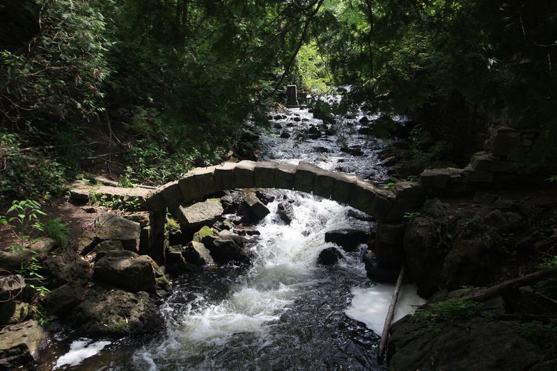
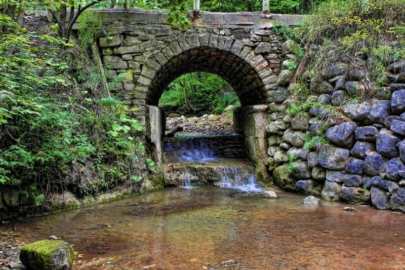
The Limehouse Conservation Area has just under 5 kilometers of trail in total, which may deter some hikers from visiting the area. Nonetheless, the area makes for an interesting day excursion. The Kiln Trail, although short, features reconstructed limestone kilns and ruins along its length. Other trails feature outcrops of the Niagara Escarpment. The Bruce Trail runs through 1.5 kilometers of the park, connecting Limehouse to other conservation areas in Halton Hills. This section of the trail goes through the “Hole-in-the-Wall,” which you’ll need to navigate via two ladders, then goes along the former Toronto Suburban Radial Railway line, as well as crossing Black Creek. The area is known for deep rock fissures and crevices, so even though the trails aren’t very long, there’s plenty to explore on a hiking excursion in this Niagara Escarpment conservation area.
5. Hungry Hollows Trail
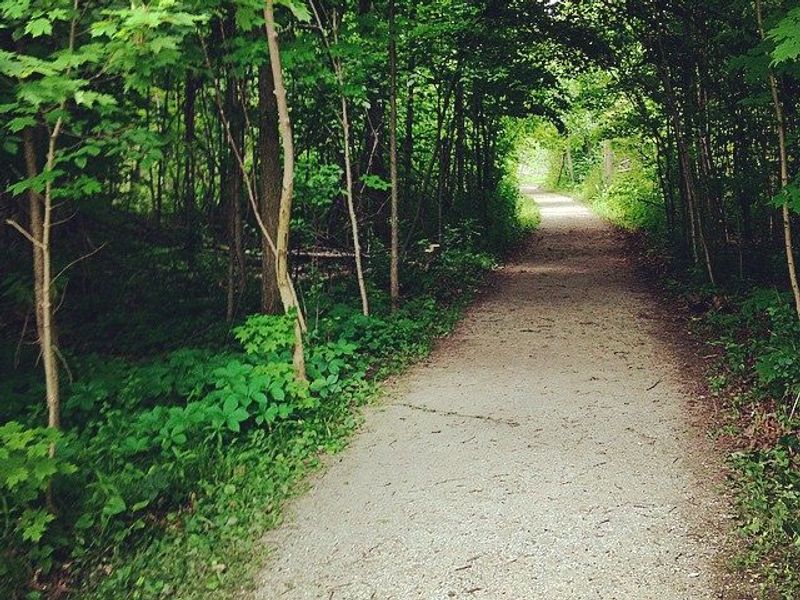
This well-maintained trail is located along the Silver Creek branch of the Credit River, nestled in a valley to the south of Georgetown. The trail extends west to Cedarvale Park and east toward Norval. The total length of the trail is approximately 5.40 kilometers. Since 2009, the trail has featured 385 meters of boardwalk as well, as part of an expansion plan intended to create a network of multi-use trails in the 95-hectare area. Hungry Hollow includes beaver ponds and meadows, and features a number of footbridges over Silver Creek. The trail features mixed surfaces, ranging from asphalt to gravel to woodchip, which makes some sections of the trail friendly to others outdoor enthusiasts such as cyclists. Other sections of the trail are better suited to travel on foot. Hungry Hollow is maintained in the winter as well, making it ideal for winter hiking and activities like cross-country skiing.
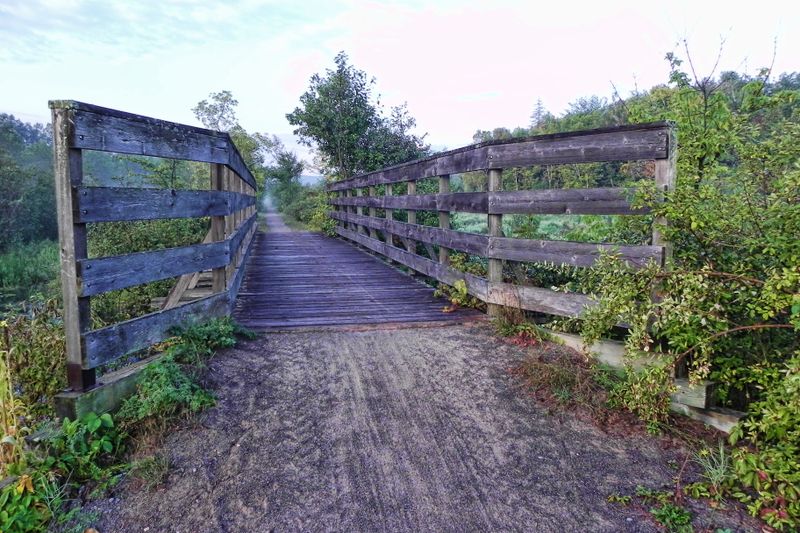
4. Terra Cotta Conservation Area
Terra Cotta is a small village just outside of Caledon, located near Winston Churchill Boulevard. Although the iconic Cheltenham Badlands and their red hills were once the most popular tourist attraction, the area was closed off due to conservation concerns in early 2015. The Terra Cotta Conservation Area is still open, however, and offers visitors 10.5 kilometers of hiking trails in all seasons. Some of the trails are open and groomed for skiing and snowshoeing in the winter, and hiking most of the trails is possible year-round. The Bruce Trail also connects through the area. Hike around the Spring Pond on the McGregor Spring Pond Trail or make your way by Wolf Lake on the Terra Cotta Lane, one of the longer trails, and enjoy the varied terrain. In winter, the Terra Cotta Lane offers four kilometers of groomed trail for winter sports enthusiasts.
3. Silver Creek
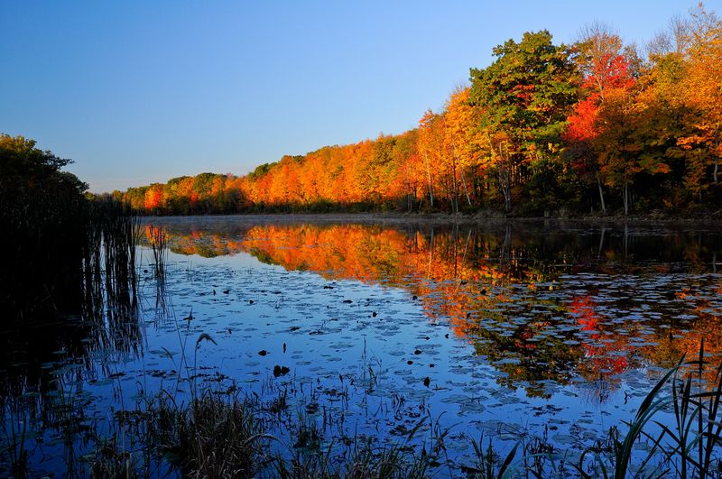
The Silver Creek Conservation Area, owned and operated by Credit Valley Conservation, is 1,080 acres of conservation land near the Terra Cotta Conservation Area. The park has over 14 kilometers of trails, including just over 6 kilometers of the Bruce Trail. The Great Esker Trail clocks in at almost 4 kilometers. The area itself includes the headwaters of Silver Creek, a tributary of the Credit River, and a large Escarpment valley. The area has no steep inclines, but some sections of the park are hilly, which means there are some great lookout points along the way. While the Bruce Trail forms the major section of this hike, the side trails offer the chance to get off the beaten path and see some more of Halton Hills and Niagara Escarpment country.
Advertisement
2. Chris Walker Trail
Formerly known as the Trafalgar Trail, this stretch near Georgetown was renamed in 2008 to honor the late Chris Walker, a long-time Bruce Trail volunteer who promoted trail linkages in Georgetown and throughout Halton Hills. Clocking in at 6.6 kilometers, the trail is by far the longest single trail in the Georgetown and Halton Hills area. The trail runs near the center of Georgetown’s historic downtown and Remembrance Park, with its gardens and fountain. The trail features a mix of surfaces, including gravel, municipal sidewalks and woodchip areas. In its 2013 budget, Halton Hills had earmarked money for trail renewal and development, with improvements to the Chris Walker Trail specifically noted. In early 2015, bids for revitalization of the trail, including construction of boardwalks, were opened, so it’s likely that this trail will become an even better experience in years to come.

1. Caledon Trailway Path
The Caledon Trailway follows the path of an abandoned railway, which was purchased in 1989 by the Town of Caledon. The trail itself extends for 35 kilometers, northeast toward Tottenham, where it terminates. The start of the trail, however, is located in Caledon Hills, near Terra Cotta, which places a good chunk of the trail in Halton Hills. The trail forms a portion of the Trans-Canada Trail, which means that if you want to keep going you can. The path takes you along rolling countryside near Caledon and Palgrave. Woodlots, beaver dams and farm fields make up much of the scenery. At one point, the trail crosses the Credit River and through a valley of the Humber River. It then crosses a number of creeks and waterways at other points as well.
Advertisement